
Walk a Greenwood Street
Begin with a bounded part of the street, not a vague postal label. Greenwood County GIS can help place the address in its parcel setting, while the Assessor and Register of Deeds use different identifiers for different purposes. Write down the exact street spelling, direction and suffix, cross streets, ZIP, map number if displayed, and any lot, subdivision, or legal-description clue. Greenwood is the county seat, but a Greenwood mailing address can still fall outside City limits or within another part of the Joint City/County Planning service area.
Ownership evidence and evidence that someone was present at an address are different things. The Greenwood County land-record chain identifies parties to a recorded instrument. Dated Greenwood library material can offer a household lead for its own year. The strongest result comes from keeping the source date and role beside each name, rather than turning one property entry into a current roster.
- Verify the delivery address and record the full street form, ZIP, and cross streets.
- Use the Greenwood County GIS viewer to map-browse the segment and use Search, Select, or Info as the interface permits.
- Take the visible parcel or map clue to the Greenwood County Assessor and distinguish the physical site from a correspondence address.
- Search the Greenwood Official Records Quick Search with a party, subdivision, document type, or document number and a recorded-date range.
- Check the legal description and prior-reference language before following an earlier transfer.
- For a dated household lead, ask the Greenwood County Library whether a volume has a street or reverse section, then compare it with maps, notices, and other records from the same period.
Note: A current postal city name does not establish City jurisdiction, parcel identity, or a complete list of people at an address.
Greenwood Street Identifiers
One Greenwood address may appear in four forms. The situs address tells where a parcel lies. A map number identifies the parcel for county administration. A legal description ties the interest to a lot, block, subdivision, plat, or metes-and-bounds description. A mailing address tells the government where a taxpayer elects to receive correspondence. The Assessor’s mailing-address form is keyed to map numbers, which is a useful reminder that a correspondence destination is not a statement of where an owner lives.
Record each form without replacing one with another. This matters when a modern number is absent from an older deed, when a parcel was split or combined, or when a postal ZIP conflicts with the jurisdiction shown in a planning file. The parcel and legal description are often the durable links across those changes.
- Parcel or map number
- A county identifier for a piece of land, used in assessment and mapping work.
- Situs address
- The physical street location of the parcel or building.
- Plat
- A recorded map that can show lots, blocks, and subdivision layout.
- Criss-cross directory
- A directory arranged by address rather than by surname; confirm that a particular Greenwood volume includes one.
Greenwood GIS Street View
The public Greenwood GIS interface visibly offers Map Layers, Search, Map Themes, Select, Info, Web Maps, 3D, Print, and Sign In. Greenwood County Library describes the map context as including parcels, state House districts, CPW utilities, school-board geography, and other county-boundary information. Those tools can locate a street segment and show public geography around it. They do not establish a full resident list.
The Joint City/County Planning page shows the local planning and historic-overlay context for address research.
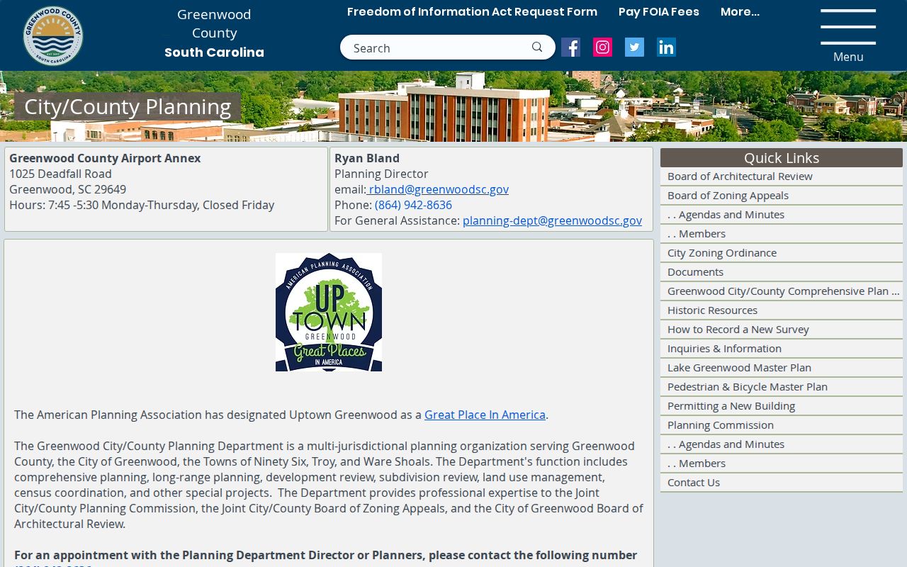
Planning records can add a project or review trail after the parcel is identified, but a project file must be checked for its own scope and date.
The public GIS capture did not verify an owner field, ZIP filter, adjacent-parcel tool, or export feature. Use the controls that are visible in the current session, record the date of the map view, and take the resulting parcel clue to the Assessor or ROD instead of assuming the map supplies every needed field.
Greenwood Street Deed Search
Greenwood’s ROD function is within the Clerk of Court structure at 528 Monument Street, Room 114. Its official quick search is the strongest verified web route for recorded property documents, but it is not an address-wide directory. The public screen accepts a grantor or grantee, subdivision, document type, or document number. It also offers a recorded-date range and shortcuts from the last 24 hours through the last year.
Use Index Only when separate entered words should be searched in indexed information. Use Index and Full Text OCR when a phrase in document contents is the goal. Documents themselves require a verified account. At the Greenwood counter, the Clerk reports public terminals and index books, and staff may help visitors use those tools without conducting the research for them. Documents delivered after 4 p.m. can be recorded the next workday and may take up to one work week to appear online.
| Greenwood ROD control | Use | Important limit |
|---|---|---|
| Greenwood Real Property department | Sets the public quick-search context | Other departments were not exposed in the inspected screen. |
| Greenwood Search Term | Enter grantor/grantee, subdivision, document type, or document number | No public address field was verified. |
| Greenwood Recorded Date | Bound a search with start and end dates | The portal does not state its first online-index year. |
| Greenwood relative dates | Use recent-period shortcuts | They do not replace a full date range. |
| Greenwood Index Only | Search indexed terms separately | Choose a scope before searching. |
| Greenwood Index and Full Text OCR | Search multiple words as a phrase in document contents | OCR results still need record-by-record confirmation. |
When a deed is available through the verified-account route or at the counter, log the parties’ roles, recording date, document number, legal description, and prior reference. Then search the earlier seller as grantee and verify that the legal description still matches. A party’s mailing or later document appearance is not proof of a later street address.
Greenwood Street Record Routes
Different address-keyed sources answer different questions. Each route has a defined role, so a street search does not overstate what a parcel outline, land instrument, planning case, or historical notice can tell. The counter and request paths matter because several local sources do not provide a confirmed public browse screen.
| Greenwood record route | What it can establish | Access path | What it does not establish |
|---|---|---|---|
| Greenwood GIS map browse | Greenwood parcel boundaries and selected public map context | Greenwood GIS Search, Select, and Info controls | A full household roster or unverified owner fields. |
| Greenwood Assessor counter | Greenwood map-number and assessment administration | Greenwood Room 109, 528 Monument Street; 864-942-8537 | A guaranteed public online owner search. |
| Greenwood ROD quick search | Greenwood document parties, subdivisions, dates, and document clues | Greenwood public screen, verified account, or counter/index books | A complete street-wide resident list. |
| Greenwood plat and legal description | Greenwood lot and subdivision continuity | Greenwood ROD and SCDAH plat-book route | A person’s current presence at the site. |
| Greenwood Planning or permit file | Greenwood project, zoning, variance, or work timing | Greenwood Building, Planning, or a scoped county request | Ordinary occupancy or an unverified public history search. |
| Greenwood Library material | Greenwood dated directory, newspaper, map, or obituary lead | Greenwood Genealogy Room or bounded research request | Continuity through years without supporting evidence. |
For a county-held record that is not online, use Greenwood County’s NextRequest portal under SC FOIA. Name the custodian, street address, parcel or map number, date span, and known project or case number. The statute does not require an office to create a new record, and protected information can be withheld or redacted.
Greenwood Street Planning Files
Greenwood address history can sit outside the deed index. Greenwood’s Joint City/County Planning Department handles development and subdivision review, land-use management, zoning, variances, code-clearance, stormwater, flood, and historic-overlay work. Rezoning and variance matters go through public hearings, and written letters about a case become part of the Greenwood project file. A request should use the exact address, project description or case number, and a narrow timeframe.
The City/County Building Department uses a CitizenServe permit route. Applicants create or use an account, select a permit type, complete the form, and submit. Types without a Submit Online option require a printed form by email or fax. Staff process the application, assign a permit number and amount, then issue the permit after confirmed payment. The instructions do not establish a public historical search by address.
For an older Greenwood street, Planning’s material on Uptown Greenwood and Old Greenwood Village overlays can explain why a public review file exists. It can document work or land-use context, not every person connected with the address. Note: A permit or planning record is most useful when it is paired with the parcel, project date, and the actual file.
Greenwood Street Directory History
For people connected with an earlier Greenwood address, the historical shelf is the right next step. The Lawrence Genealogy Room at Greenwood County Library holds city directories, maps, archives, vertical files, local newspapers, and special collections. Its research-request form specifically lists a Greenwood City Directory with an oldest confirmed volume from 1908. The official sources do not publish a full title-by-title run or prove that every volume contains a reverse section, so ask staff about the exact year and arrangement before treating it as a street index.
A dated directory entry is a lead, not a permanent address claim. Copy the printed spelling, street address, title-year, page, and abbreviation key, then compare it with an obituary notice, census material, deed, or plat from the same period. The historical collections themselves are described in greater detail in the Greenwood city directories collection.
Greenwood County Library also supplies an obituary index for the local newspaper stream, starting with the Greenwood Journal in 1895. That is useful for placing a family in time, although a notice can be sparse and does not by itself establish a street address.
Greenwood RMC Record Gap
The Greenwood online search box has no published starting year. That absence matters. A web form is not evidence that every early Greenwood instrument has been digitized. For older land work, move from the portal to the Clerk/ROD’s public terminals and index books, then to the South Carolina Department of Archives and History Greenwood County guide.
The archive lists 63 reels of Greenwood RMC conveyance books for 1899 through 1923, two reels of master’s conveyance books for 1904 through 1923, and seven reels of plat books for 1912 through 1945. Greenwood County was formed in 1897 from parts of Abbeville and Edgefield. For a property event before county formation, a parent-county or state-held group may be the correct place to search.
The office name itself changed from Register of Mesne Conveyances to Register of Deeds on January 1, 1998. Search both RMC and ROD terminology when matching current office material with archival descriptions.
Greenwood Street Change Checks
No official source located a Greenwood citywide renumbering year, grid origin, directional convention, or ZIP realignment date. That is a real gap, not a reason to guess. Test an older number against the legal description, subdivision, plat, and cross streets. Then compare the modern parcel view with dated maps and the title year of a local directory.
Library of Congress Greenwood Sanborn maps provide building and street snapshots for 1884, 1889, and 1904. The 1904 set has six sheets. These maps can show a street layout, building footprint, or land-use notation, but they do not name a complete household. Pair them with the 1908-or-later directory lead and the recorded land chain.
Greenwood Street Voter Limits
MySCVOTES is a personal registration-confirmation service, not an open street browse. Its Check My Registration process requires the voter’s name, county, and date of birth as it appears on the voter-registration card. The system can support a person checking their own status, polling place, sample ballot, or voting history. It does not support a claim that anyone can list registered voters along a Greenwood street.
A full South Carolina voter list follows a separate regulated purchase path. Only a registered South Carolina voter may purchase it, and the state sets the available criteria, delivery methods, fees, and use rules. Participation history reports elections, not ballot choices. The Family Privacy Protection Act limits commercial solicitation using personal information obtained from state or local government records. Treat missing online confirmation as inconclusive because inactive status can make a record unavailable online.
Historical voter records are different again. SCDAH lists Greenwood Clerk voter-registration books from 1900 through 1906 and precinct lists from 1948 through 1966. Ask the archive or reading room about access and visible fields rather than assuming a digitized street list exists.
Greenwood Street Directory Limits
A street directory can assemble public property, document, map, and historical leads, but no single Greenwood source verifies every current person at an address. Utility customer records, library-patron records, DMV personal information, restricted court files, and protected vital records are not an address-search substitute. A property owner’s correspondence address is also not permission to contact that person or proof of current residence.
South Carolina’s Address Confidentiality Program provides a substitute government-record address for qualifying victims of domestic violence, human trafficking, stalking, harassment, or sexual offenses. Separate online-record protections took effect in 2026 for eligible active or former law-enforcement and corrections officers. The public display can therefore be limited even when a custodian still holds an underlying record.
Lawful use. Greenwood street and property records are for personal, lawful research. Do not use any address detail to stalk, harass, intimidate, or harm another person.